Modern systems for fleet management and vehicle GPS tracking offer hundreds of features for every business domain. In general, companies use 20% of GPS software functionality. But there are must-have features to consider when choosing a system for your business.
We based our analysis on 10,000+ vehicles connected to FiOS fleet management systems. We analyzed how transport managers and dispatchers use the system and determined the demanded features and modules.
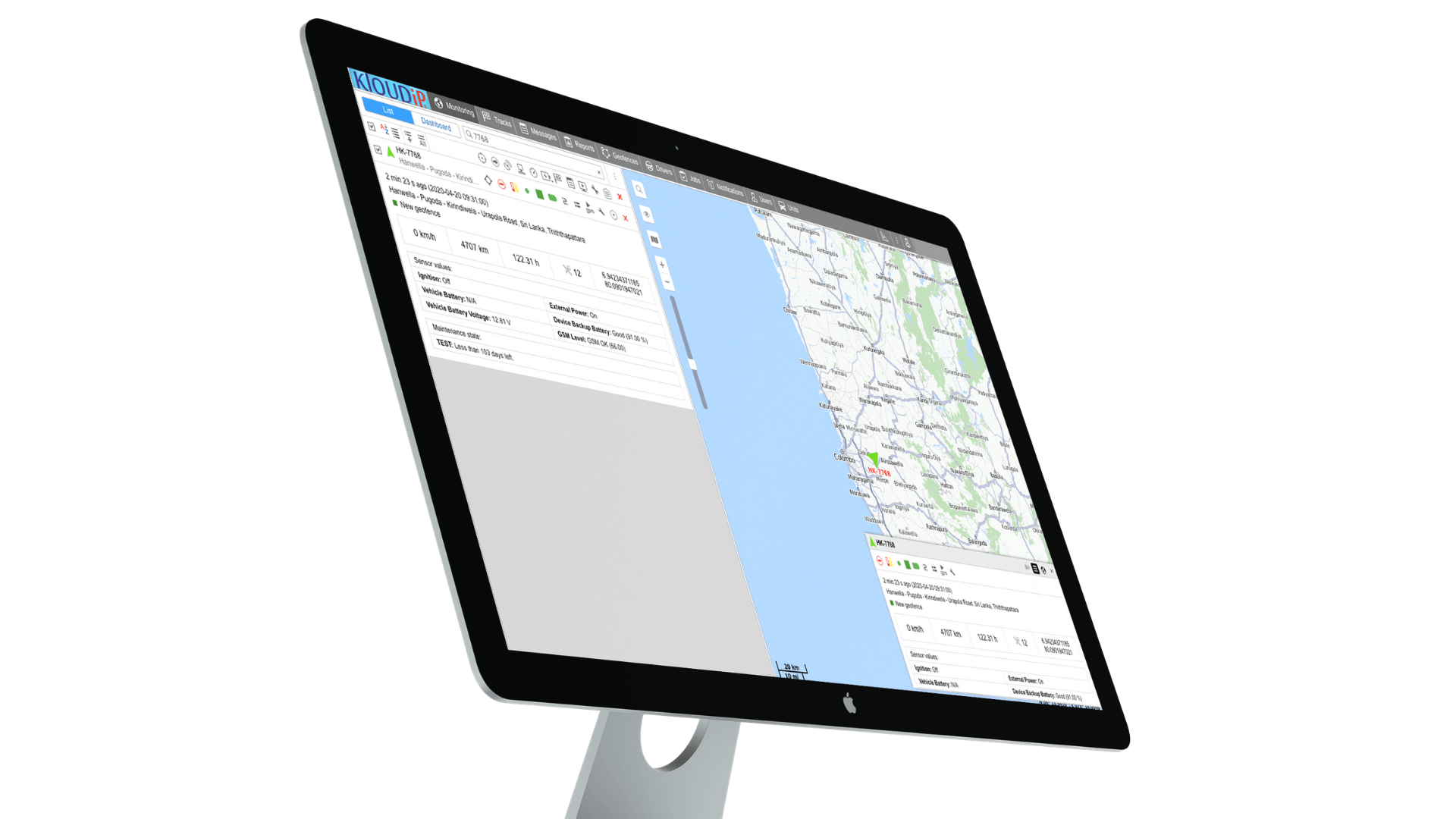
100% of FiOS users track transport in real-time. There are several options for online vehicle GPS tracking.
The system displays all vehicles that you track in the worklist. Here, you see extensive information about each tracked unit updated in real-time.
Thanks to all the information above, you can track your vehicles in real-time, not even looking at the map.
On the map, you see all your vehicles moving smoothly relative to other transport, buildings, and areas of interest. You can find any object on the map in seconds via the monitoring worklist or “Search” tool. Zoom in the map to track vehicles in a particular area, or zoom it out to get all your transport in sight.
In FiOS, you can choose between free WebGIS and OpenStreetMaps or connect Google Maps.
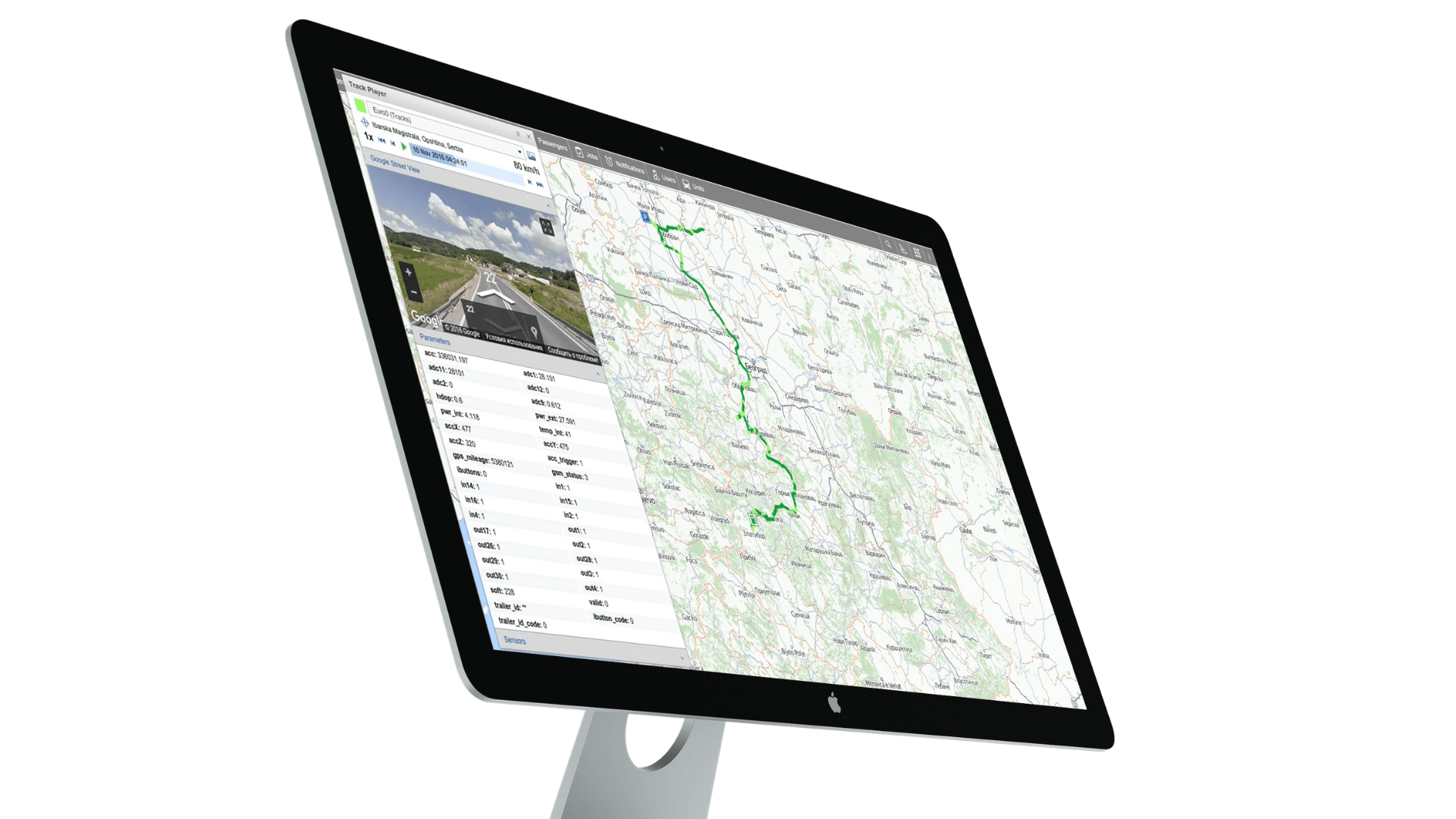
If you track vehicles on Google Maps, at any moment, you can open a mini-window showing Google Street View at the place where your vehicle is now. As it keeps moving, Google Street View already updates the picture, so you see the road with your own eyes without video cameras on your vehicle.
“Notifications” is another module that will help to track vehicles without staring at the map all the time.
If something happens with your vehicles – traffic violations, thefts, entering an area, freezer temperature variations – the system will send you alerts and notifications. FiOS can notify you in several ways:
Quick notifications will inform you about everything happening to your fleet you are – just take your smartphone with you.
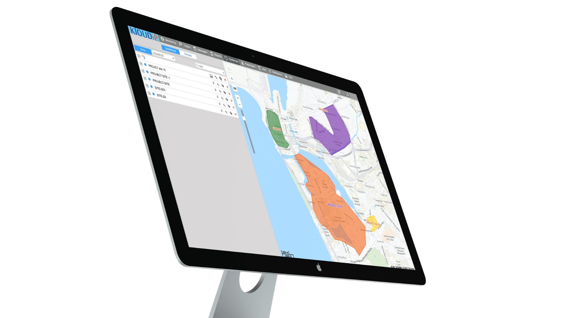
Geofences are areas that you mark on the map to control vehicles inside or outside it and vehicles entering or leaving the territory. Those who use geofences for vehicle GPS tracking usually mark the following locations.
Here are a few locations you can mark with geofences in FiOS:
In FiOS, you can create several types of Geofences.
Special “Geofence-based” notifications will inform you about everything happening within the places of your interest.
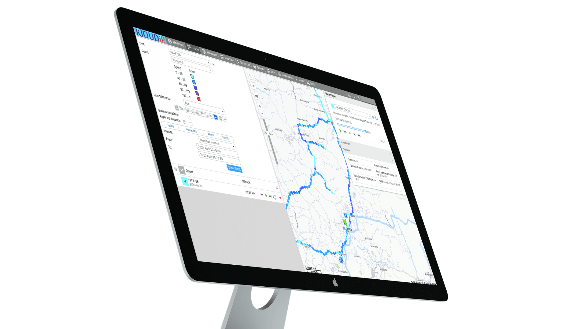
The track is a colored line on the map showing vehicle movements during the specified interval. Let’s see how it works in practice.
For example, you want to know where your sales guys have been during work hours. You go to the “Tracks” tab in the monitoring system, select his car, and enter the 9 AM to 5 PM time interval. You see that the driver made one trip from home to KFC, while he was supposed to visit ten clients. And the other one has been in all parts of Colombo and vicinities, while he was supposed to have only one meeting.
Tracks show where your vehicles were and how drivers performed at every point of their trips.
For example, you can add event markers on every track. These markers will show where the driver stopped, parked, filled/stole fuel, violated speed limits, and much more.
Moreover, you can configure track color to change depending on vehicle speed, sensor state, or other conditions. For example, in the city, your vehicle drives at 55 km/h but then accelerates to 90 km/h for some time. The segment of the track where the driver violates traffic laws is marked with a different color. Same with seatbelts. You can build the track showing the segments where the driver wasn’t fastened.
FiOS also offers “Track player” functionality. It looks just like an average video player, but instead of videos, it replays vehicle movements along the track. We call it, “play the track.” That way, you can see the history of vehicle movements as if in real-time.
In FiOS, you can create and play any number of tracks for up to 400 days.
You can share the location and movements of your vehicles with anyone – even people who don’t have access to the GPS software. In FiOS, you can do it via the Locator tool. Here are a few examples where you can use the tool:
In FiOS, location-sharing is done through a simple link. You create a link to a vehicle’s location and movements and send it to any person by email or messenger. The person opens the link and sees the car’s movements in his browser on a laptop or smartphone.
Some additional FiOS features will make working with links easier.
You can schedule activation time for the link. For example, if you know that students board the school bus at 8 AM. Then, you can create the link and share it with parents in advance, but it will become active only at 8 AM.
Plus, you can specify the link’s lifespan. For example, if you know the goods should be delivered in 30 +/- 5 minutes, set 35 minutes as a life span – after the time passes, the link will be deactivated, and buyers can no longer track the couriers’ movements.
It’s all about basic vehicle GPS tracking. As you see, even the basic functions of GPS tracking systems will allow you to control your transport remotely. Next time we’ll discuss advanced features of fleet management systems. Subscribe to our blog to stay tuned!
P.S. If you prefer viewing to reading, check out all these features explained by Yasintha Vithanage, KLOUDIP’s Chief Technical Officer:
All about GPS tracking for lorries: GPS equipment, vehicle tracking systems, and apps for heavyweight…
All about the new software where 3PL operators, cargo senders, fleet owners & managers cooperate.
On January 20, 2023, KLOUDIP hosted the renowned Telematics Colombo 2023 conference attended by Brandix,…
Check out tech innovations that will power up businesses in 2023 and introduce them to…
KLOUDIP visited Europe to present its IoT solutions to companies from 130 countries. This post…
Does IoT solutions influence the lives of average citizens? Well... Every morning you shower with…